You can follow my progress on trackleaders.com.
 |
| My bike and I at Picketpost Mountain. |
Here's a map of the AZT 300 route:
 |
| My bike and I at Picketpost Mountain. |
 |
| I think we're ready. |
 |
| First gate. |
 |
| Crossing under US 60. |
 |
| Wide |
 |
| Open |
 |
| Spaces |
 |
| Trying out new fashion options. |
 |
| One of many creek crossings. |
 |
| Jake riding away. |
 |
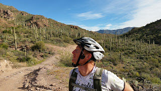
| Rugged Arizona beauty. |
 |
| Nice gate. |
 |
| Pose with bikes. |
 |
| Green |
 |
| Ready to crash in the grass |
 |
| Direct line of sight means full cell service! |
 |
| Standing on top of the world. |
 |
| Take in the view a bit longer. |
 |
| Time to get moving. |
 |
| The other side of the mountain. |
 |
| Almost there. |
 |
| No bikes allowed. |
 |
| Jake in the distance. |
 |
| More water. |
 |
| Typical section of the road. |
 |
| Water tank. |
 |
| Looking for Indian ruins. |
 |
| Watch for caution tortoises! |
 |
| Time for an apple! |